The earliest known map is the subject of some debate since the definition of a map is not clear and since some artifacts thought to be maps might be categorized as something else. An example of this is a wall painting, which may be the oldest map, depicting the ancient Anatolian city, Çatalhöyük, which has been dated back to the late 7th millennium BCE.
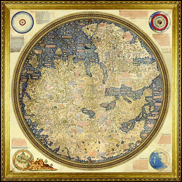
The ancient Greeks and Romans had maps of their own too. The latest being Anaximander in the 6th century BC, but the most known being in Ptolemy’s discourse on cartography, Geographia, written in the 2nd century AD. This work contained Ptolemy’s world map according to what the Western society knew at the time.
During the medieval times, European maps were centered on religious views. T-O maps (also O and T maps, or O-T maps) were common during that time. They depicted Jerusalem in the center and east towards the top of the map. These maps were named this because of how they look like the letter T inside of an O with Europe being on the bottom left, Africa on the bottom right, and Asia on top.
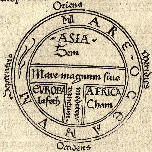
The 7th-century scholar, Isidore of Seville, depicts the known world through a T-O map in his Etymologiae (chapter 14, de terra et partibus):
(translated)
“The [inhabited] mass of solid land is called round after the roundness of a circle, because it is like a wheel... Because of this, the Ocean flowing around it is contained in a circular limit, and it is divided in three parts, one part being called Asia, the second Europe, and the third Africa.”
They made maps according to what they knew of, which were the three semi-connected continents.
Creating maps has clearly been of great interest to early peoples. Perhaps this stemmed from the interest in the unknown. Now that we have all of the information about maps that we need, we seem to not regard it as much, yet we seem very interested in another type of cartography, astrology, and even outer space in general. I believe this is because we don’t have as many answers about it as we do geography.
Through maps, we can tell much about a certain group of people as with the Europeans cantering their maps on Jerusalem and how that reflects themselves (as a generality) centered on their church.
This is very true that you can see what was important to people through their maps. Each country would put something different in the center of the map. Ex, in England we have England as the center and American, usually it's the Americas in the center. You can also use maps to control a people. Changing a map would change people's perceptions. A government (back when information was not freely given) could change a map around and people would have to believe them because they didn't know anything else.
ReplyDeleteSo true. The people in ancient civilizations would not have the time or resources to go explore and find out if a map was true or not; they would just have to accept it. Maps could maybe influence thinking by placing one area (or a represented concept, like Madi was saying about the church) at the center, conveying its importance. Maps could also intimidate smaller countries, especially disproportionately drawn ones.
ReplyDeleteRecently I had a conversation with two friends. One had drawn a picture of the world, and at first the second friend didn't recognize it as the world. The first one had to point out South America as the featured continent, before the other could recognize it. I thought that was really interesting. Emily, what makes you think we are any less simply trusting of the map makers?
ReplyDeleteUsually the map makers were commissioned by the authority of the time. So yes, we have to trust the maker's integrity and the person who has power over them.
ReplyDeleteThat's so weird that we have such a limited world view that a different orientation makes a map unrecognizable. But like you were saying, Emily, this could influence a culture and the way they view the earth and their role in it, both individually and as a country as a whole.
ReplyDeleteKimberly, I think the point we are all working around here is that in general our view of the world is somewhat artificial because we tend to interact with the larger world only in limited ways, and through second hand presentations (like maps). I want to know if you all think this is an acceptable way to live, or if before we propose to draw conclusions about the world should we have a more authentic experience with it?
ReplyDeleteI think the word "authentic" summarizes it all. Having a true experience in a different culture is the only way to be able to gain a true analysis of the culture. Since it's basically impossible to experience every culture, we just have to make sure that sources aren't biased or tainted.
ReplyDeleteOr at least we can discern to what degree our sources are biased/tainted and in what way. Then maybe we can work backwards for a truer picture. (Because I highly doubt you can find a truly unbiased source.)
ReplyDelete